
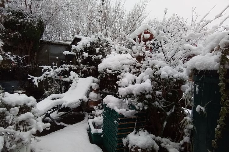
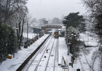
SNOW and ice is set to come to Devon and Cornwall as the Met Office issue weather warnings amid forecast freezing temperatures and inclement weather.
It comes as the ‘Pembrokeshire Dangler’ weather phenomenon, which brought snow to Cornwall last year make a return to once again bring a true taste of winter across the area.
The Pembrokeshire Dangler is a weather phenomenon, a distinct, narrow band of heavy showers often comprising of snow, sleet, or rain that forms over the Irish Sea in late autumn and winter, driven by cold northerly winds clashing with warmer, moist air.
This causes a "lurch" and convergence that funnels intense precipitation onto Pembrokeshire, Cornwall, and Devon. This "streamer" or "convergence line" can bring localised, persistent heavy snow or rain for hours, creating significant disruption, as seen in notable events in 2005 and 2025.

Ice
6pm on Friday, January 2 to 10am, Saturday January 3
A spokesperson for the Met Office said: “This warning has a medium likelihood and a low impact.
“Showers of rain, sleet and some snow, the latter mainly over higher ground, will affect parts of southwest England during Friday evening and overnight into Saturday morning. Where showers occur, icy stretches will develop on untreated surfaces.Whilst many areas will see little accumulating snow, there is potential for a cm or two of snow over Bodmin Moor, the west of Dartmoor and Exmoor.”
Snow and Ice
3pm on Sunday, January 4 to 12pm, Monday, January 5
A spokesperson for the Met Office said: “This warning has a medium likelihood and a low impact.
“Snow showers are expected to push further inland across Wales, parts of northwest England, the West Midlands and southwest England during Sunday evening. Along windward coasts, rain and sleet is more likely, but inland showers will fall as snow.
“Whilst not all locations in the warning areas will see snow, around one to three centimetres is expected to fall in many places by Monday morning, with the potential for five to eight centimetres to build up in a few locations, particularly across inland and higher parts of Wales. Icy patches are likely to form widely.”
Met Office advice
The spokesperson added: “Snowy, wintry weather can cause delays and make driving conditions dangerous. Keep yourself and others safe by planning your route, giving yourself extra time for your journey. Check for road closures or delays to public transport and amend plans if necessary. Keep yourself and your family safe when it is icy. Plan to leave the house at least five minutes earlier than normal.
“Not needing to rush, reduces your risk of accidents, slips, and falls.If you need to make a journey on foot, try to use pavements along main roads which are likely to be less slippery. Similarly, if cycling, try and stick to main roads which are more likely to have been treated.
Give yourself the best chance of avoiding delays by checking road conditions if driving, or bus and train timetables, amending your travel plans if necessary.If driving, make sure you have some essentials in your car in the event of any delays (e.g., warm clothing, food, water, a blanket, a torch, ice scraper/de icer, a warning triangle, high visibility vest and an in-car phone charger).
“Be prepared for weather warnings to change: when a weather warning is issued, the Met Office recommends staying up to date with the weather forecast in your area.”
Comments
This article has no comments yet. Be the first to leave a comment.